About Securing Water in Agriculture Decision Support System
A spatial decision support system for agricultural water resilience, jointly developed by the Digital Innovations for Water Secure Africa project of IWMI and the CGIAR Sustainable Farming Science program.
Securing Water in Agriculture Decision Support System
A decision support system powered by geospatial intelligence that enables data-driven decisions to optimize irrigation supply, reduce dependence on external water sources, and promote sustainability.
What is Securing Water in Agriculture Decision Support System?
A cloud-based DSS that compares water use and crop water requirements across space and time, identifying opportunities for water reallocation and storage within community-managed water systems to improve irrigation sufficiency.
Why Securing Water in Agriculture Decision Support System?
Globally, irrigation systems face a dual challenge: excessive water use in some areas and chronic shortages in others. An estimated 41% of irrigation water use exceeds crop requirements, while 42% of croplands experience water scarcity for at least five months each year. Digital solutions can help optimize irrigation supply, reduce waste, and improve water security.
Where can we use Securing Water in Agriculture Decision Support System?
Securing Water in Agriculture Decision Support System is a scalable framework that can be applied in any irrigation setting (from small to medium to large-scale irrigation systems) where information on crop type is available.
The Challenge
Irrigation systems around the world are highly uneven. In many areas, crops receive more water than they need, while in others, farmers struggle with insufficient supply. Studies show that 41% of irrigated use constitutes over-irrigation, meaning water is applied beyond crop needs. At the same time, 42% of croplands experience water scarcity for at least 5 months a year, with crops not receiving enough water.
These figures refer to different places and times, but together they highlight a common problem: water is often misallocated rather than simply scarce. This imbalance leads to both water waste and reduced agricultural productivity.
Improving how water is managed and distributed within agricultural systems is key to reducing both waste and shortages.
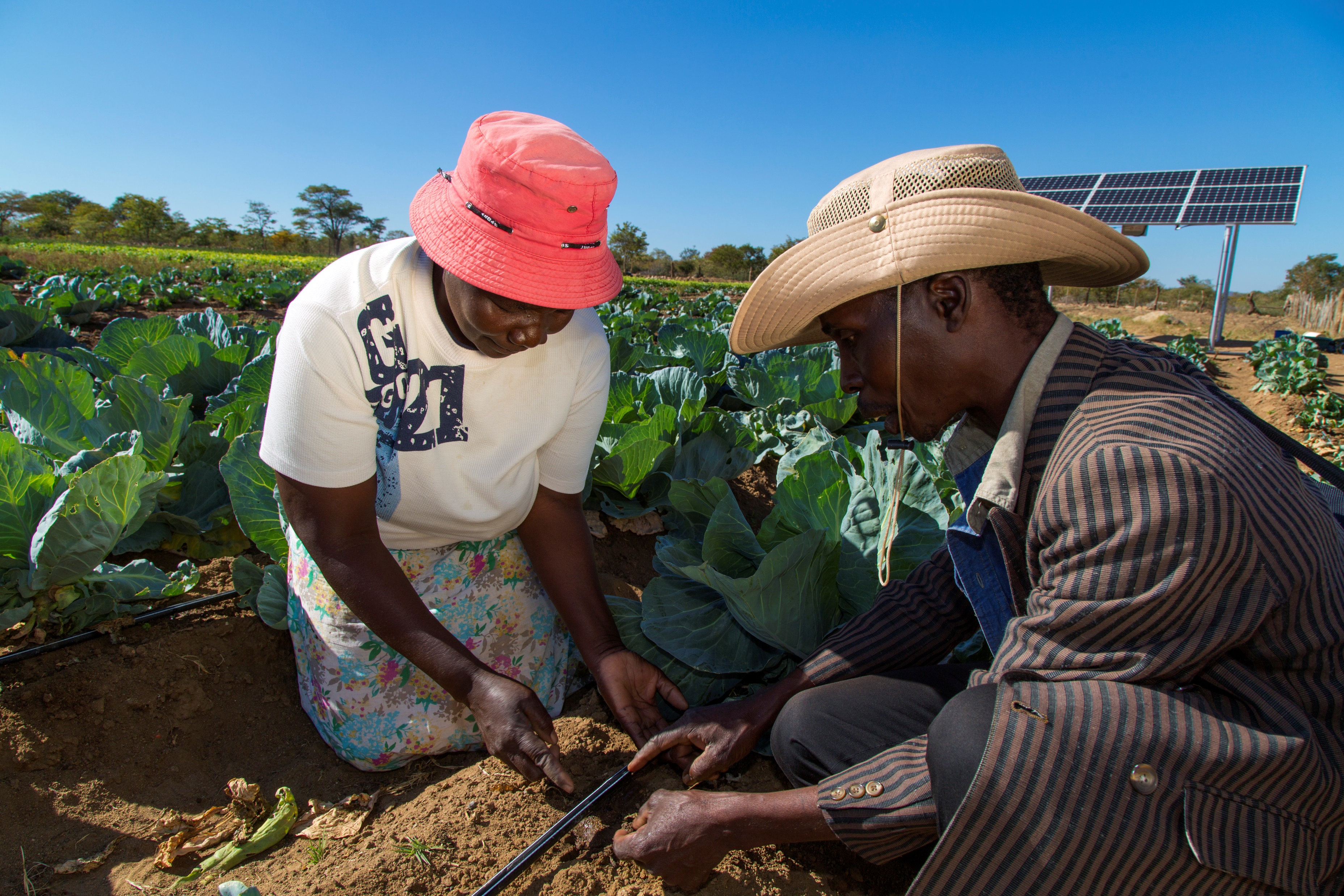
The Solution
A spatial decision support system for integrated water resources management for irrigation systems, jointly developed by the Digital Innovations for Water Secure Africa project of IWMI and the CGIAR Sustainable Farming Science program to address this challenge.
IWMI's Digital Innovations for a Water Secure Africa (DIWASA)
DIWASA is committed to leveraging digital innovations such as remote sensing, cloud computing, open data initiatives, and eventually machine learning to enhance the accessibility of water data throughout the African continent. The primary emphasis of DIWASA lies in Water Accounting and Resilience applications, which encompass a diverse range of products tailored to various scales. These DIWASA products will be progressively disseminated through Digital Earth Africa and the Africa Geoportal.
DIWASA has been developed in partnership with Digital Earth Africa, with the generous support of the Leona M. and Harry B. Helmsley Charitable Trust.
CGIAR Sustainable Farming Initiative
A global effort to promote farming systems that are productive, climate-resilient, and environmentally sustainable. It brings together research, innovation, and partnerships to help farmers improve yields while conserving natural resources like soil and water.
The initiative focuses on:
- Developing climate-smart agricultural practices
- Improving water and land management
- Supporting smallholder farmers with data and tools
- Reducing environmental impacts such as land degradation and emissions
Three Approaches to Closing the Agricultural Water Gap
Three approaches explore how far water needs can be met through redistribution alone, storage alone, or a combination of both.
Reallocation only
Redistributing surplus water to nearby downstream areas with deficits by gravity. No infrastructure data is required. Reduces deficit volume by up to 10%.
Storage only
Small ponds capture runoff during wet months for use in dry periods. Meets water deficits up to half the time in 47% of watersheds and >90% of the time in 17% of watersheds.
Reallocation + Storage
First redistributes available surplus water locally. If deficits remain, use small ponds to meet unmet deficit. Increases the reliability of deficits being met up to half the time by 20%.
How It Works
Securing Water in Agriculture Decision Support System follows a seven-step calculation pipeline for each WRUA and watershed.
Identify
Identify rainfed and irrigated croplands as well as crop types and associated cropping calendars.
Compare
Compare crop water demand to water consumption (evapotranspiration) over cropland areas.
Classify
Identify areas where water consumed is in deficit, optimal, or surplus compared to crop water needs.
Extract
Calculate deficit and surplus water volumes for small watershed units.
Reallocate
Redistribute surplus water within the same WRUA, allowing local transfer where feasible (low slope, less than 3%) and otherwise routing it downhill to adjacent watersheds along the lowest-friction path.
Storage
Estimate the potential number of small ponds that could and should be built per watershed based on long-term average runoff and the deficit.
Check
Check metrics on reallocation and storage and identify priority watersheds for reallocation and storage solutions.
Use Case: Central Highlands Ecoregions Foodscape (CHEF)
The Central Highlands Ecoregions Foodscape (CHEF) program, led by The Nature Conservancy (TNC), aims to transform central Kenya into a regenerative food system where agriculture supports healthy soils, reliable water supplies, and biodiversity.
At the heart of this region is Mount Kenya, a UNESCO World Heritage Site and Africa's second-highest peak. It is one of Kenya's most important water towers, supplying water to major rivers such as the Ewaso Ng'iro River and Tana River, which support agriculture, wildlife, and millions of people. Despite covering less than 10% of Kenya's land area, the Central Highlands contain around 25% of the country's cropland, making it a critical agricultural hub. This high concentration of farming and reliance on water makes the CHEF region an ideal case for application of Securing Water in Agriculture Decision Support System for improving how water is managed, shared, and stored within the landscape.
The Securing Water in Agriculture Decision Support System for CHEF covers 119 formed Water Resources User Associations (WRUAs), of which 110 are modelled in detail under the CHEF program.
3
Reallocation scenarios
34
Cropping systems
119
Total basins
60
Months of irrigation analysis
Hover any WRUA for name, basin, and area.
Data Inputs
Generic categories of data the Securing Water in Agriculture Decision Support System uses. Specific sources vary by deployment.
- checkLandcover
- checkCrop type and cropping calendar
- checkEvapotranspiration
- checkPrecipitation
- checkRunoff
- checkDigital Elevation Model
- checkWater management units (e.g. WRUs, small watersheds)
CHEF datasets (this use case)
Specific data products used for the CHEF deployment.
| Data Type | Source | Resolution | Period |
|---|---|---|---|
| Precipitation | CHIRPS | 5 km, monthly | 2019 - 2023 |
| Reference ET | WaPOR v2 | 100 m, monthly | 2012 - 2021 |
| Crop-specific coefficients (kc) | FAO 56 | - | Static |
| Runoff | Model-derived | Subbasin | Monthly climatology |
| Elevation | SRTM DEM | 30 m | Static |
| Sub-watersheds | Watershed flow accumulation | ~9 km2 | Static |
| WRUA Boundaries | WRA Kenya | Vector polygons | Static |
Glossary
Key terms and abbreviations used throughout the DSS.
- CHEF
- Central Highlands Ecoregions Foodscape: the focal region for The Nature Conservancy's regenerative foodscape program in central Kenya.
- CWR / CWD
- Crop Water Requirement / Demand: total water needed by crops during a growing season, derived from FAO-56 crop coefficients and reference evapotranspiration.
- Deficit / Surplus
- Deficits and surpluses are calculated by comparing water consumed (actual evapotranspiration) with crop water requirements (CWR). Areas consuming more water than required are classified as surplus, while areas consuming less than required are classified as deficit. The map color scale shows the annual deficit volume for each sub-watershed in m³.
- Ec · Ea · E
- Conveyance efficiency (Ec), application efficiency (Ea), overall irrigation efficiency (E = Ec × Ea).
- Retained fraction
- Share of natural runoff captured and held by farm ponds over a year. An environmental check caps the basin-annual retained fraction at 20% so downstream flows are not over-attenuated.
- Storage only
- Small farm ponds (typically 1,000 m³) that buffer wet-season runoff for dry-season irrigation.
- Sub-watershed
- A small drainage unit derived from a 30 m DEM flow accumulation. Each has a unique ID (shown in the UI as "WS {id}").
- WRUA
- Water Resource Users Association. A community-based body managing water resources within a defined sub-catchment.
Institutional Partners and Projects
Projects
-
Sustainable Farming Program
-
Digital Innovations for Water Secure Africa (DIWASA)
Partners
- CGIAR
- The Nature Conservancy (TNC)
- National Irrigation Authority, Kenya (NIA)
Supported by




Contact
[email protected]